
Written By Shweta Ganjoo
Published By: Shweta Ganjoo | Published: Jul 08, 2024, 05:30 PM (IST)
![]() Image: Ola Electric
Image: Ola Electric
Written By Shweta Ganjoo
Ola Maps launched in India: Ola Electric launched indigenously built navigation service, Ola Maps in India today. The newly launched Ola Maps is built on Krutrim, which is a generative AI-based assistant developed by Ola. ![]() Also Read: What is NemBharat now to take on Ola, Uber after Bharat Taxi launch
Also Read: What is NemBharat now to take on Ola, Uber after Bharat Taxi launch
“After Azure exit, it’s time for Indian developers to Exit Google Maps. 1 YEAR FREE access to all developers to Ola Maps on Krutrim more than Rs 100Cr in free credits,” Ola Electric founder Bhavish Aggarwal wrote in a post on X (formerly Twitter) announcing the development. ![]() Also Read: ‘Pay Rs 500, become co-owner’: Bharat Taxi’s Amul-style model explained by Amit Shah
Also Read: ‘Pay Rs 500, become co-owner’: Bharat Taxi’s Amul-style model explained by Amit Shah
After #ExitAzure, it’s time for 🇮🇳developers to #ExitGoogleMaps! 1 YEAR FREE access to all developers to Ola Maps on @Krutrim, more than ₹100Cr in free credits! https://t.co/K1JHFBlNt1
Also Read: Amit Shah launches Bharat Taxi App in India to challenge Ola, Uber, and Rapido: What's different?
We’ve been using western apps to map India for too long and they don’t get our unique… pic.twitter.com/18l2GdzCkC
— Bhavish Aggarwal (@bhash) July 8, 2024
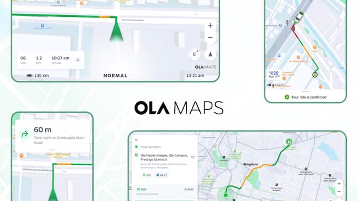
Here are the top features offered by Ola Maps:
— Ola has aggregated data for Ola Maps from its fleet of Ola S1’s equipped with 360 cameras, open-source government data repositories, OpenStreetMap, partnerships and other proprietary sources. The company says that in the past one year it has contributed a total of 5.43 million edits to Open Street Maps.
— Ola Maps offers preference-based routing feature, which tailors routes to a user’s and the vehicle preferences. It also offers popularity-based routing that suggests commonly used paths.
— Ola Maps also supports real-time speed predictions and historical speed predictions that provide accurate ETAs taking into account obstructions and road closures. It also suggests routes that are free from disruptions.
— The Nearby Search feature lets users find locations within a specified area.
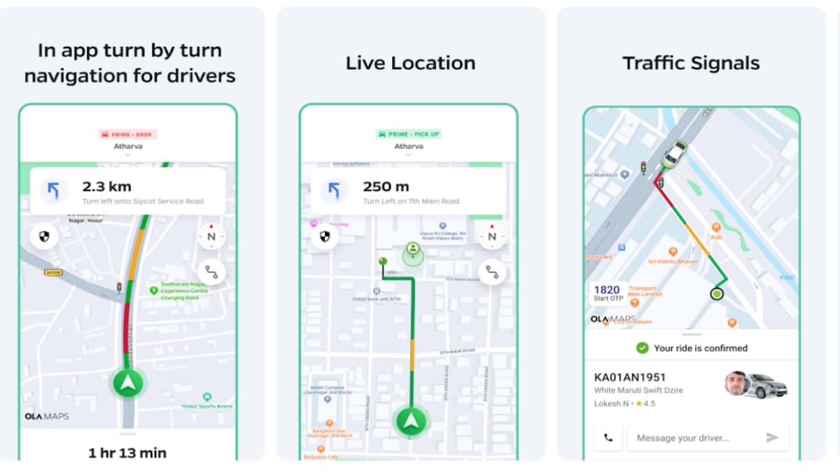
Image: Ola Electric
— Ola Maps supports a feature called Directions, which provides turn-by-turn navigation instructions to guide users from their starting point to their destination.
— ETA calculates the Estimated Time of Arrival based on a user’s current location and historical traffic data to provide accurate travel times.
— Snap to Road aligns user-reported positions to the nearest road, correcting any GPS inaccuracies to reflect real-world driving paths.
— Map Matching feature in Ola Maps ensures that GPS traces are accurately aligned with the road network by matching them to the correct paths on the map.
— Multi Stop Routing enables users to plan and navigate routes with multiple destinations, optimising the order of stops for efficiency.
— Live Location lets users share their love location with other users.
— Traffic Signals feature shows users all the points where they will encounter a traffic light in their route.
Don't Miss Out the Latest Updates. Subscribe to Our Newsletter Today!