Written By Pranav Sawant
Published By: Pranav Sawant | Published: Mar 12, 2024, 10:29 PM (IST)

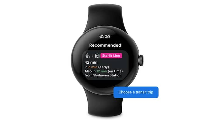
Google has just updated the Pixel Watch’s navigation experience with the latest features on WearOS. The Google Maps app on WearOS now gives you different public transit options, real-time departure times, and a compass-enabled map view for easier navigation. These features have been already rolled out to Pixel Watch in its latest Pixel drop. Also Read: Mappls App Adds Bus, Metro And Rail Routes To Rival Google Maps In India: Here's How It Works
“Google Maps on Wear OS can now give you public transit directions on your Pixel Watch to help find the best route. You’ll see different transit options, real-time departure times, and a compass-enabled map view to guide you to your destination. Start a trip from your phone to see directions on your watch, or if you have an LTE-enabled watch you can start a trip right from your wrist,” noted Google in its blog post. Also Read: Forgot Where You Parked? Google Maps Can Help You Find Your Car
Get public transit directions right from your wrist 📍
Also Read: How To Take Google Maps Anywhere Without Internet
Now you can see different transit options, real-time departure information, and more on your #PixelWatch with @GoogleMaps on @WearOSbyGoogle.¹
This way to learn more about our latest #FeatureDrop² ➡️ https://t.co/CkbIPtLvga pic.twitter.com/pKcIzXIOZE
— Google India (@GoogleIndia) March 12, 2024
These new features come through the WearOS and they are already rolling out. That said, you might have received the feature. Let’s see how you can see public transit directions and real-time departures on the Google Maps app on your Pixel Watch.
Step 1: Open the Google Maps app on your Pixel Watch.
Step 2: Search the destination you want to visit. You can either type it or do a voice search.
Step 3: After you search for the destination, you should see different options. Tap on the relevant one.
Step 4: Scroll to the bottom and tap on the Public transit option.
Step 5: Now, you should see the real-time departure times. This means you will see if you reached the destination early or late. Tap on the transit option to see more details.
Step 6: Scroll down and tap on Show map. Now you should have a compass-enabled map view as default.
That’s how you can easily see public transit directions on Google Maps and make your navigation experience better with real-time departure timings and compass-enabled map view.