
Written By Deepti Ratnam
Published By: Deepti Ratnam | Published: Oct 13, 2025, 01:24 PM (IST)
Written By Deepti Ratnam
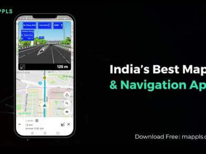
A smart navigation app called Mappls was launched in India called Mappls by MapMyIndia. The app is a push for self-reliant technologies in India with an aim to compete a global giant, Google’s Maps. Union Minister Ashwini Vishnaw recently tested the app and highlighted the importance of domestic innovations and their capabilities of matching international standards.
Mappls is launched with an aim to push Atmanirbhar Bharat and reduce reliance on foreign technologies that maximize the risk of user data security.
Mappls is launched in India to enhance road travel with a variety of intelligent tools. The app comes with 3D junction views along with real-time driving alerts. In addition, users will also be able to have precise doorstep navigation, enhancing the travel experience and its efficiency.
Other than this, Mappls will also allow users to calculate travel costs in advance and receive warnings about accident-prone areas in advance. There will be notifications for speed breakers and access to live updates on traffic signals and CCTV cameras.
The Indian government is planning to integrate Mappls into railway systems via an upcoming MoU. This collaboration will further enhance the app’s capability in station navigation and train travel management.
Privacy
The app’s main focus will be on data security and privacy. The app will not work like any foreign platforms that store user information abroad. Mappls will keep all map and user data within India, ensuring greater privacy protection.
The company behind Mappls, MapmIndia, also developed DIGIPIN, which is India’s new digital address system. The DIGIPIN is developed in collaboration with India Post, IIT Hyderabad, and ISRO’s NRSC. It generates unique code for every 3.8 square meters across the country.
Additionally, DIGIPIN will enable accurate location identification even in rural areas. Users can pin precise locations down to floors and house numbers. However, in rural mapping, the app will use nearby landmarks as reference points.
Don't Miss Out the Latest Updates. Subscribe to Our Newsletter Today!